Isabella County Interactive Map
Parcel Search, Map Viewer & Land Records
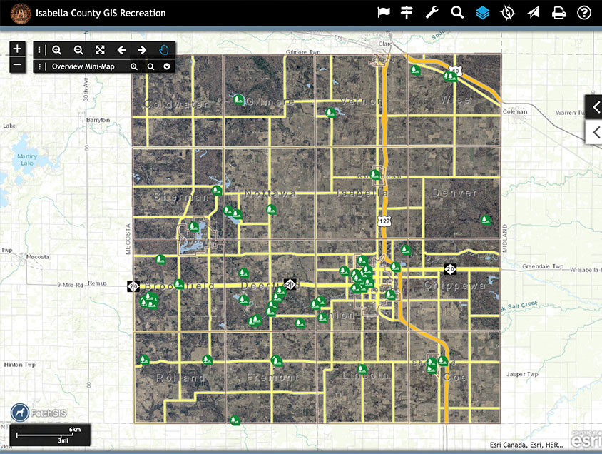
Pick and choose between displaying tax parcels, land use, zoning, parks and recreation, and transportation and public safety GIS information within Isabella County. The new tools for information analysis include improved parcel and graphic buffers, enhancements to printing and emailing live maps to other users, and a layer swipe function allowing a user to analyze imagery between two different years.
Previously, lower bandwidth users could access the Land Records Portal, a text-formatted data search. With the enhancements made to the new interactive map viewer, including streamlined integrated mobile viewing, faster searches, and improved design, all information is now available in one efficient location. Please click on the Equalization Department link to view tax and assessment information
Please be sure all bookmarks are updated to the new link. Hint: You can select your preferred theme and then create a new bookmark to always open the viewer at your preferred theme!


Interactive Map Viewer and Land Records Portal History
In 2007, the Isabella County Community Development Department released its “pilot” Map Viewer and Parcel Information Search tools to the public. The tools allowed users to access and view information throughout the County. With nearly 150,000 page hits and an overwhelmingly positive reception by users, the Community Development Department is now releasing an updated version of both the Map Viewer and Parcel Information Search.
The new Interactive Map Viewer has an enhanced full-screen view which includes enhanced functionality such as Buffer Tools, Drawing Tools, and individualized printing functions. With the new design and functionality additional data has been added to the map contents such as 2009 Aerial Imagery.
The Land Records Portal also has a new design for users interested in text-formatted data or who are limited by the speed of their internet service.
This Rich Mapping Application has been developed to serve those who are interested in our community. The Rich Mapping Application provides access to Isabella County information through the use of a geographic information system (GIS).
Experienced users and first-time users are encouraged to click the question map symbol in the upper right-hand corner of the website, this link provides access to help topics. When opened there is a menu that includes links that describe how to use the website. This includes how to use the Toolbars, the Map Contents window, and the Search window.
GIS Interactive Map News
![]()